Thinking about local history - Step by step local study
Article
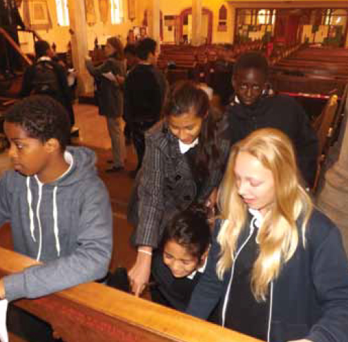
The short walk from our school to St Mary's Parish Church, Leyton, takes us past late Victorian terraces, post-Second World War apartment blocks and early twentyfirst century social housing in one of the most densely populated and ethnically diverse parts of East London, sandwiched as it is between Stratford and Walthamstow, at the poorer southern end of the London Borough of Waltham Forest. As we enter the mid-seventeenthcentury church, however, we are surrounded by evidence of a very different Leyton: a reclining statue of the secretary to William Cecil, Lord Burghley; monuments to a Commander of Royalist forces in the Civil War and a director of the East India Company; the grave of an early eighteenth-century Lord Mayor of London; and a Governor of Maryland who owned 26 slaves. Although it's a fascinating resource, only one of my 60 students in Year 9 had ever set foot in the building. Now they were exploring the church interior and graveyard, estimating the ages of the buildings they passed on the way and comparing the layout of the surrounding streets with an 1800 map of the area.
Until the mid-nineteenth century this was a prosperous market gardening and cattle-rearing community profiting from the rich soil and verdant pasture of the marshes alongside the river Lea. It was also where many very rich families lived in their ‘great houses' in extensive grounds...
This resource is FREE for Secondary HA Members.
Non HA Members can get instant access for £2.75